


Description
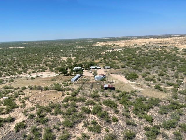
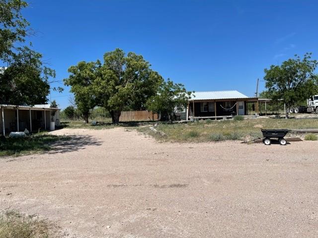
This ranch has been well-known for being a quality cattle ranch and for many years. Average rainfall is 13 inches. The topography of this ranch is relatively flat ranging from 2,660 to 2,745; however, there are some distant views from several spots on the ranch mostly from the crown of the sand hills. The dunes are part of a vast set of dunes the lie east of the Pecos River between Fort Stockton and the New Mexico border. The Crane County sand formations are part of the ensemble that includes the Monahans sand hills and the Kermit dunes. The ranch is fenced entirely with a five-strand barb-wire fence on wooden posts and cross fenced. Headquarters is an older and modest arrangement of 1,440 sq ft. It consists of a 3 b/1 ba main house central hea/air, bunk/hunter house, equipment barn on slab, covered stalls, & shipping pens. The house is a 3 br. 1 ba., central air and heat, and is used by the deer hunters. There is a set of welded pipe working pens.

Rooms
Interior
Exterior
Lot information
Financial
Additional information
*Disclaimer: Listing broker's offer of compensation is made only to participants of the MLS where the listing is filed.
View analytics
Total views

Estimated electricity cost
Mortgage
Subdivision Facts
-----------------------------------------------------------------------------
----------------------
Schools
School information is computer generated and may not be accurate or current. Buyer must independently verify and confirm enrollment. Please contact the school district to determine the schools to which this property is zoned.
Assigned schools
Nearby schools 
Listing broker
Source

Selling Agent and Brokerage
Nearby similar homes for sale
Nearby similar homes for rent
Nearby recently sold homes
00 FM 1233, Crane, TX 79731. View photos, map, tax, nearby homes for sale, home values, school info...